See the City
These cycling routes are tailored for both visitors and locals eager to explore, sightsee, and savour the pleasures of Newcastle.
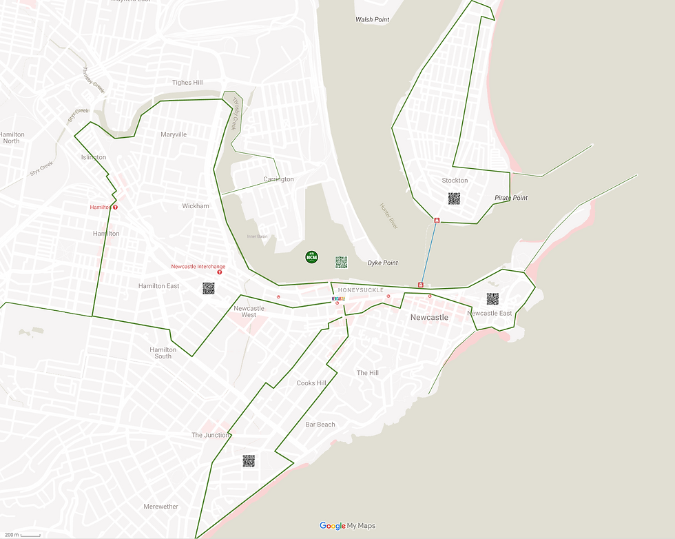
Each route originates and concludes at the Newcastle Visitor Information Centre. There are four circuits - north, east, south, and west - each approximately 6 kilometres long and predominantly flat. Most routes offer additional segments for those seeking an extended journey. Upon returning to the Visitor Centre, you have the option to embark on another circuit for a more extensive ride.
The routes are accessible via "Google My Maps," which will launch in a web browser on your mobile phone. iPhone owners may benefit from downloading the "Google Maps" app for an improved experience.
We have started to map these routes in detail using the komoot app which you can get on your mobile phone to get 'turn-by-turn' navigation. Please see the tours on komoot at https://www.komoot.com/collection/3083694/-see-the-city-newcastle-inner-city-loops
Have a great time!
Make a visit to Stockton - Newcastle's northern suburb - to see the sand dunes stretching into the distance, go bird watching at the wetlands and see the remains of a shipwreck.
From the Visitor's Centre, ride to Queens Wharf and catch a ferry (bikes are allowed) to Stockton.
Ride loop clockwise (can be ridden anti-clockwise) - for detailed map click here


See the Foreshore, Nobbys Beach, take a swim at the Ocean Baths and return via the city.
Ride loop clockwise - for detailed map click here.
Green loop is 5.25 kilometres long and generally very flat. There can be lots of pedestrian traffic on the foreshore, the path to the Baths and to Newcastle Beach so please be considerate and ride at an appropriate speed. After the city section the green loop does travel a short distance on King St; less experienced riders might prefer to take the right-hand turn at Harry's Cafe De Wheels to rejoin the Foreshore Footpath.
Grab a coffee on Darby St, get sand between your toes at Bar or Merewether Beach, and have a game of lawn bowls on your return.
Ride loop clockwise - for detailed map click here.
The green loop is 7 kilometres with a total of 40 metres of climbing. Some of that climbing is to get you off Darby Street before the traffic gets busier, but after that is much flatter.


Take a relaxing ride along the shores of Throsby Creek and then sate your hunger on Beaumont St, Hamilton.
Ride loop anti-clockwise - for detailed map click here.
The full loop is 10 kilometres with less than 10 metres of elevation change. The family friendly option is to ride the green sections to Islington Park (or less) and return the same way for a total distance of 8.5 kilometres.


